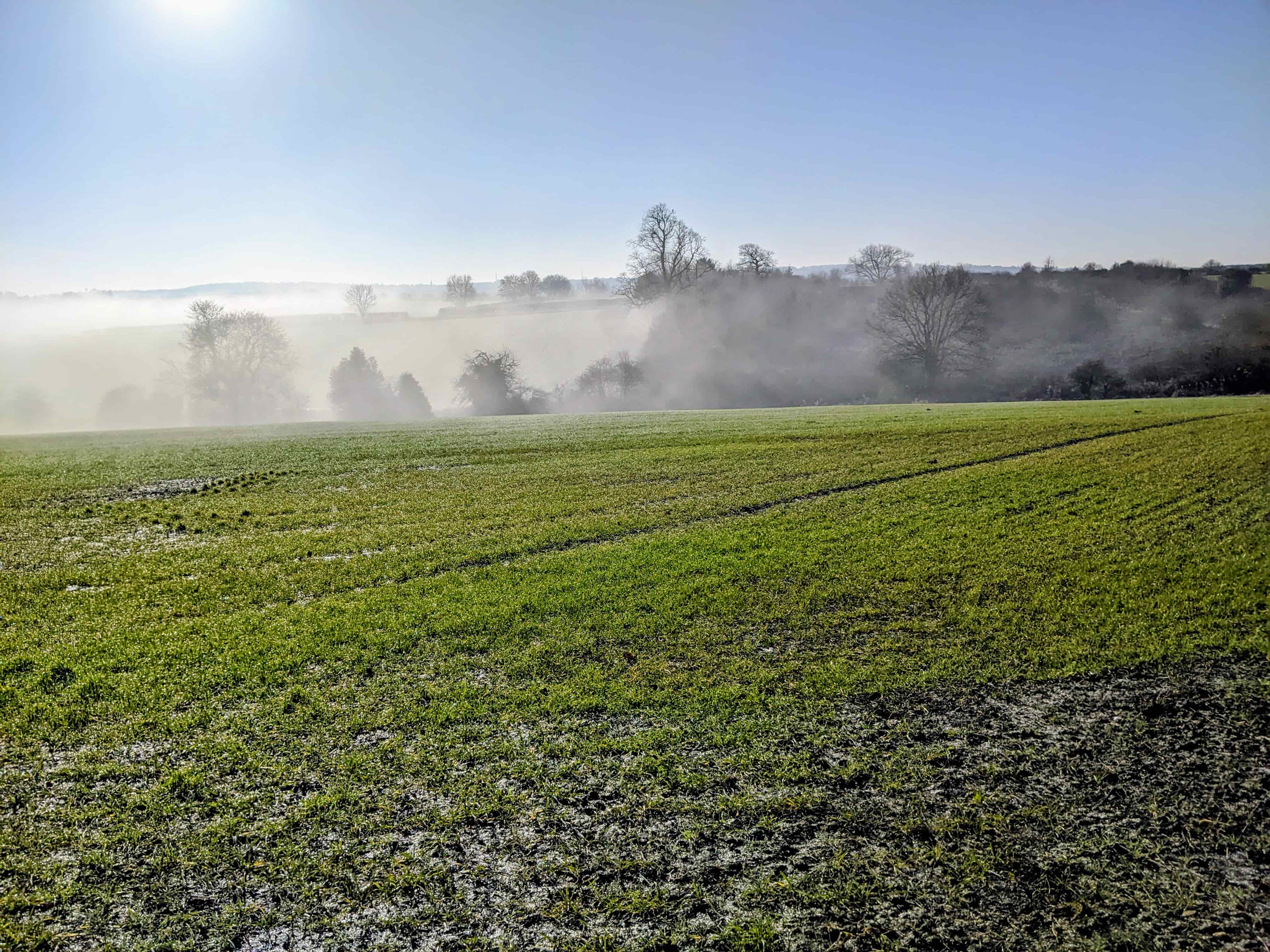
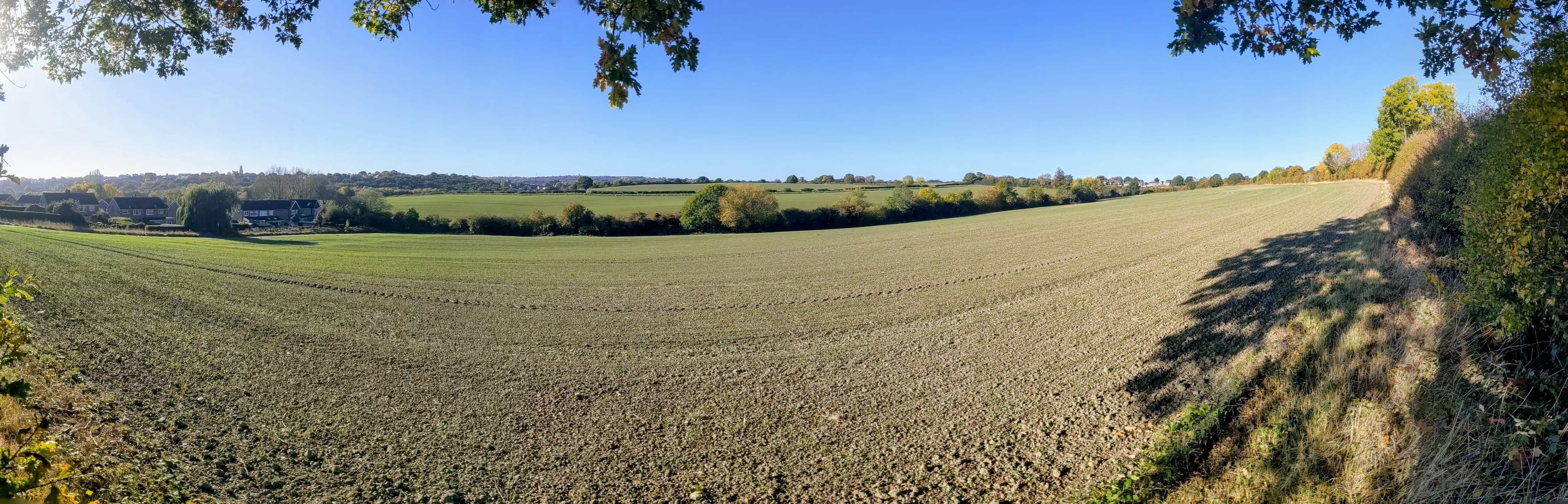
Do you know Handsworth Hall Farm (SES29) or Bramley Common (SES30)? Have you seen wildlife in these fields, watched crops being grown or harvested, experienced problems on the local roads, or do you know the Quaker burial ground at Cinder Hill Green? Your local knowledge can help the Planning Inspectors assess the new proposals and evidence.
Three or four sentences of your own are enough. Replace every [square bracket] with your own words, and delete anything that does not apply. Say what you saw, where and when.
Send one email per topic, each with its reference. This consultation is about the further changes and the related evidence, so say what concerns you about those rather than repeating an earlier objection.
Leave out your home address, other people's names and any health or family details. The Council asks for this. Your full name is needed, and it will be published with your comment.
The suggested comments are ours, not the Council's. Under What the Council says, only the words in quotation marks are the Council's own. "Sound" is the Inspectors' test: is the plan justified by the evidence, and can it be delivered?
1. Wildlife in our local fields
Do you see birds, bats or other wildlife around Finchwell Road, Bramley Lane or Beaver Hill Road?
SES29 is Handsworth Hall Farm and land at Finchwell Road. SES30 is the land around Bramley Lane and Beaver Hill Road. Tell the Inspectors what uses these fields, hedgerows and the brook, and why adequate wildlife evidence matters here.
Reference: FMM5 (Policy BG1) and FMM16 (Policy GS5), and their implications for SES29 and SES30.
What the Council says
In short: the Council proposes that the protection wildlife gets should depend on survey evidence for each site (FMM16). For SES30, the field survey was one walkover on 31 July 2025.
FMM16 applies to priority habitats and species. The Council's ecology report for SES30 (EXAM153) finds that 13 sections of hedgerow on the site qualify as priority habitat (paragraphs 3.3.18 to 3.3.21). It describes a walkover as a rapid assessment of habitats that is not intended to replace targeted species surveys (paragraph 2.5.2), and it recommends further surveys for badgers, bats, breeding birds, water voles and otters (summary, page 6).
FMM5 changes a second rule. Development affecting green space, Green Belt or wildlife sites should, where relevant, be assessed against Plan policies. The Main Modifications published in March said comply with.
All four changes in FMM5, and the full wording of FMM16
It removes from the very significant weight list in Policy BG1 the green spaces that form, or could form, wildlife corridors or steppingstones between designated ecological sites.
It adds a sentence saying that, where possible, opportunities to maintain or enhance connections between designated ecological sites should be taken.
It changes comply with to where relevant, be assessed against for policies SA5, SA6, GS1, GS1A, GS2, GS5 and GS8, in the sentence on development affecting green space, Green Belt or designated ecological sites.
It adds on designated wildlife sites to the rule that biodiversity takes priority where it conflicts with human access, so the rule applies to those sites only.
FMM16 adds one paragraph to Policy GS5:
Outside of international and nationally designated sites, Priority Habitats and Species will be afforded significant or very significant weight, proportionate to their ecological value informed by site specific evidence.
The Council's report records one survey visit. Your sightings through the year add to it: what you have seen, where and when. Nesting, feeding and movement between habitats are useful details. For example: I have seen [bats] flying along [the hedge beside X Road] at dusk in [July and August].
Do not publish badger sett locations. You can say badgers are present, but leave out where. The Council's ecology report says badger records and locations must not be made public (EXAM153, paragraph 3.4.6).
Your comment: copy and edit
I am commenting on FMM5 (Policy BG1) and FMM16 (Policy GS5) as they would apply to [SES29, SES30 or both]. I do not think they are sound as drafted, for the reasons below.
I know these fields because [I live nearby / walk here / regularly watch wildlife here]. I have seen [birds, animals or other wildlife] at [location] during [month, season or year]. [Describe how they use the fields, hedgerows or brook.]
FMM16 makes the protection given to habitats and species depend on site-specific evidence. For SES30, the Council's ecology report (EXAM153) records one walkover survey and recommends further surveys. FMM5 also changes "comply with" to "be assessed against", which could weaken protection.
Please [keep "comply with" in FMM5 / require surveys in the right seasons before FMM16 is applied / do both].
Please tell me when the Inspectors' report is published.
[Your full name]
2. Local traffic problems
Do you queue on Orgreave Lane or struggle at nearby junctions during the school run or rush hour?
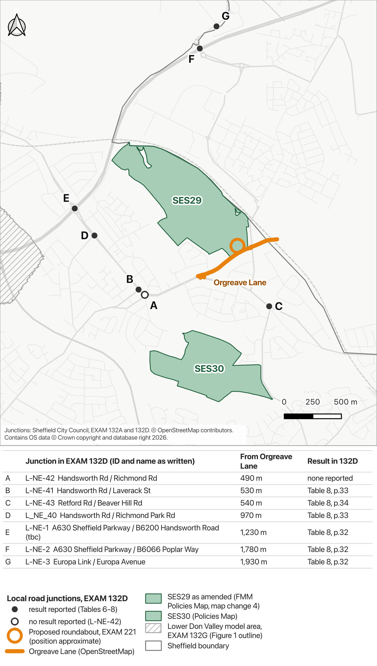
A new four-arm roundabout off Orgreave Lane is proposed to serve SES29, Handsworth Hall Farm. The allocation also requires improvements to the Retford Road / Beaver Hill Road junction (MM410), so you can include that junction and the roads around it. Explain what happens on the roads you use and what the new access evidence needs to address.
Reference: EXAM221, the new SES29 access evidence. MM410 is the earlier allocation condition, for context.
What the Council says
The developer's letter says Council highways officers have reviewed the access proposals and have confirmed that they are acceptable in principle subject to detailed design works, any further modelling required, and the required Road Safety Audit process.
The Council's transport study for the Plan (EXAM132D, 2025) picks out 56 local road junctions for detailed testing. These tests leave out the city centre, the Lower Don Valley and motorway junctions, which are covered in other reports. None of them is on Orgreave Lane.
Give the road or junction, the time of day and a specific example. Include effects on buses, walking or cycling if you have observed them. For example: On weekday mornings at about [8.15am] the queue on [Orgreave Lane] reaches [the junction with X Road] and takes [10 minutes] to clear.
Your comment: copy and edit
I am commenting on the new access evidence for SES29 in EXAM221. I do not think it shows that the access would work, so I do not think the allocation is sound as it stands.
At [road or junction], I regularly see [queues, delays, crossing difficulties or other problems], particularly [days and times]. For example, [a specific observation].
The letter reports agreement "in principle" only, subject to detailed design, modelling and a Road Safety Audit, and the Council's transport study for the Plan (EXAM132D) did not test any junction on Orgreave Lane. Nothing published shows how the proposed roundabout and the surrounding roads would cope.
Please require the traffic modelling and safety evidence to be published, including the effect on nearby junctions, pedestrians and cyclists, before SES29's allocation is confirmed.
Please tell me when the Inspectors' report is published.
[Your full name]
3. The fields as farmland
Have you watched crops growing or being harvested at Handsworth Hall Farm or around Bramley Lane?
Updated mapping suggests that SES29 and SES30 contain higher-quality farmland than the earlier assessment indicated. The Council still considers the allocations appropriate. Your experience can describe how this land is used.
Reference: Sustainability Appraisal note, Appendix B, paragraphs 2.6 and 3.2-3.3 (also published as EXAM219).
What the Council says
The Council concludes that proposed site allocations in the Plan remain appropriate.
Read the Sustainability Appraisal note. Appendix B starts on page 41 of the PDF. Paragraph 2.6 is on page 45 and paragraphs 3.2-3.3 are on page 49. The same text is in EXAM219 (PDF): paragraph 2.6 on pages 4-5 and paragraphs 3.2-3.3 on page 8.
What to tell the Inspectors
Describe crops, harvesting or other agricultural use you have seen, with the location and approximate dates. These observations describe use; they do not establish the land's agricultural grade. For example: [Wheat] was harvested from [the field beside X Road] in [August 2025].
Your comment: copy and edit
I am commenting on Appendix B of the Sustainability Appraisal note (EXAM219), paragraphs 2.6 and 3.2-3.3. I do not think its conclusion that the allocations "remain appropriate" is sound.
I have seen [crops grown, harvesting or other agricultural use] at [location] during [years or seasons].
The Council's new mapping suggests that SES29 and SES30 contain higher-quality farmland than it first assessed. The note gives no area for any grade of land and does not compare the alternatives on that basis.
Please publish the area of land in each agricultural grade for every site, distinguishing predictions from survey results, and show how reasonable alternatives using poorer-quality land compare.
Please tell me when the Inspectors' report is published.
[Your full name]
4. The Quaker burial ground
Do you know the Quaker burial ground at Cinder Hill Green and the fields beside it?
The burial ground adjoins SES30's eastern boundary. The Council acknowledges that its surroundings could be affected, but points to the housing already around it. Describe what the remaining relationship with the fields means to this historic place.
Reference: EXAM222, the Council's new note on SES30 and the Quaker burial and preaching grounds.
What the Council says
The Council acknowledges that the burial ground's setting may be affected.
Read EXAM222, page 2 (PDF). The note also says the burial ground is recommended for local listing, and that the location of the preaching ground is uncertain.
What to tell the Inspectors
Explain your connection with the place and what you know about its views, quietness or historic character. If you have relevant photographs or historical records, identify them. For example: I have visited [the burial ground] [every year since X], and [the view across the fields to the west] is part of what makes it [quiet / old / rural].
Your comment: copy and edit
I am commenting on the Council's note on SES30 and the Quaker burial ground (EXAM222). I do not think the allocation of SES30 is sound as it stands.
I know this place through [visiting, walking nearby, local history or another connection]. Its relationship with the adjoining fields matters because [describe the views, quietness, historic character or other features you know].
The Council accepts that the burial ground's "setting may be affected". Existing housing around it does not remove the need to assess what further development would change.
Please assess how development of SES30 would affect the burial ground's surroundings before confirming the allocation, and include specific protection in the site's development requirements.
Please tell me when the Inspectors' report is published.
[Your full name]
Keep this comment focused on the assessment in EXAM222 and the local evidence you can add. The burial and preaching grounds are distinct; the Council says the preaching ground's precise location remains uncertain.
Please keep the credits on any map you reuse and link back to its page.
Ready to send your comment?
Make it personal. Replace every bracketed prompt and check that the comment reflects your views and experience.
Keep the reference. Include the relevant FMM or document number so the Inspectors can see what you are commenting on. Send one email per topic.
Check it. Leave out your address, other people's names and any health or family details. End with your full name.
Send it. Copy your comment (the Copy this comment button under each topic does this) and paste it into an email to the address below. You do not need to register on the Council's website.
Suggested subject: Further Main Modifications: [your reference, for example FMM5 and FMM16]
Deadline: 5pm, Wednesday 28 October 2026.
The Council says all comments received during the consultation will be passed to the Inspectors, who will consider comments within its scope. Your name and comment will be published online. See the Council's consultation page for the full requirements.