In September 2026, trees and shrubs were uprooted and a channel dug out along Handsworth Beck, within the proposed Handsworth Hall Farm allocation, known as SES29 in the Sheffield Local Plan.
This page brings together photographs, residents’ reports, the Council’s response and the campaign’s concerns. It records the position as at 13 September 2026.
What happened at Handsworth Beck
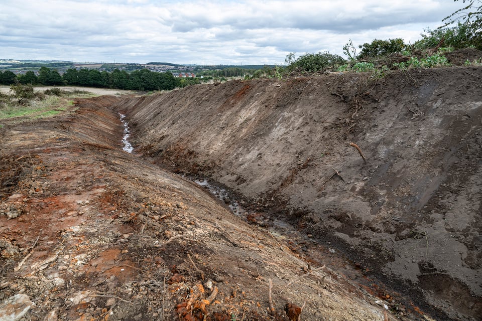
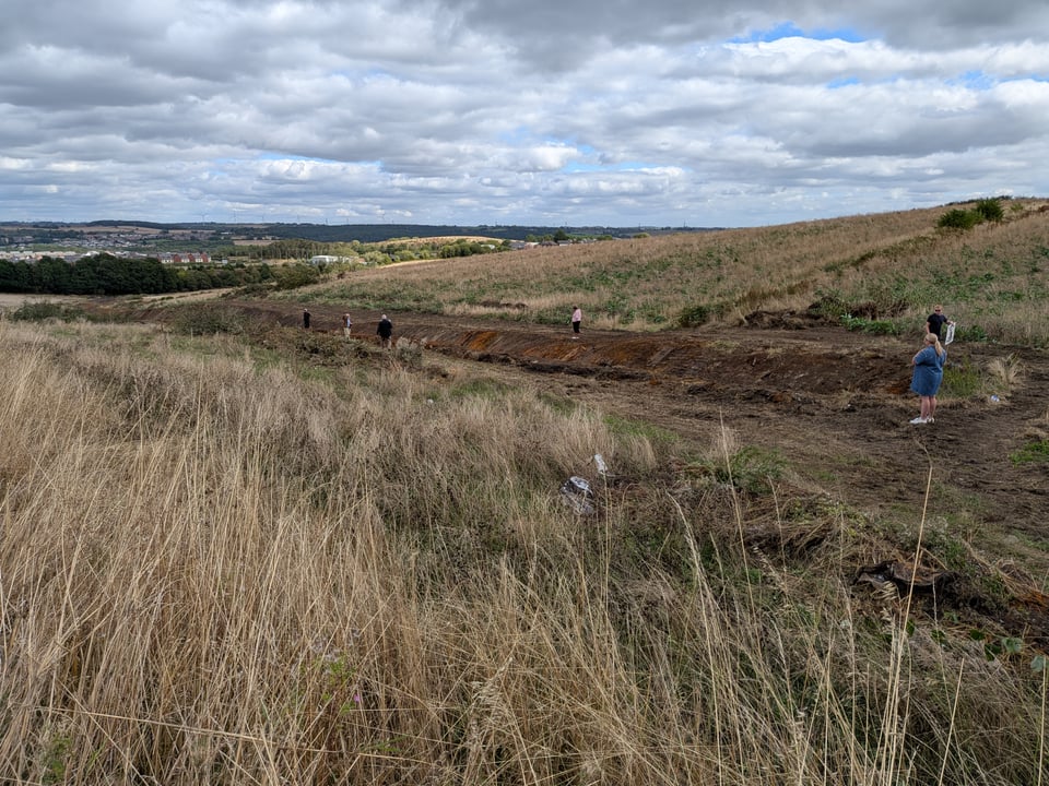
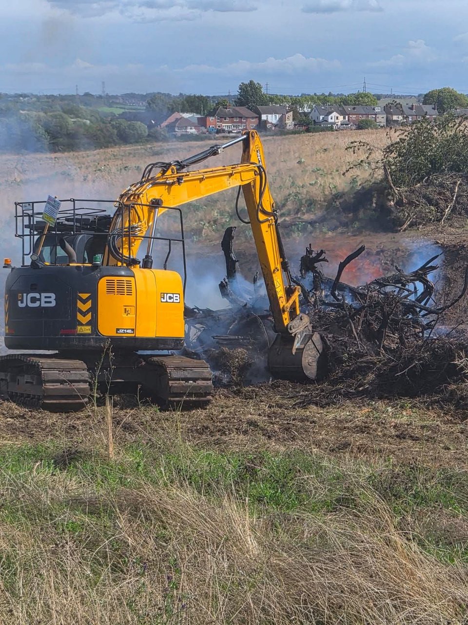
On Thursday 3 September 2026, a resident walking a footpath found a JCB at work along Handsworth Beck, inside the boundary of the proposed SES29 allocation. Over the following week, trees and shrubs were pulled out by the roots, a channel reported to be about 4 metres deep and 500 metres long was dug out along the line of the stream, and the spring-fed watercourse was reshaped. By Tuesday 8 September, uprooted trees were being burned on site.
The contractors told residents they were "widening the stream". The photographs show what that has meant in practice.
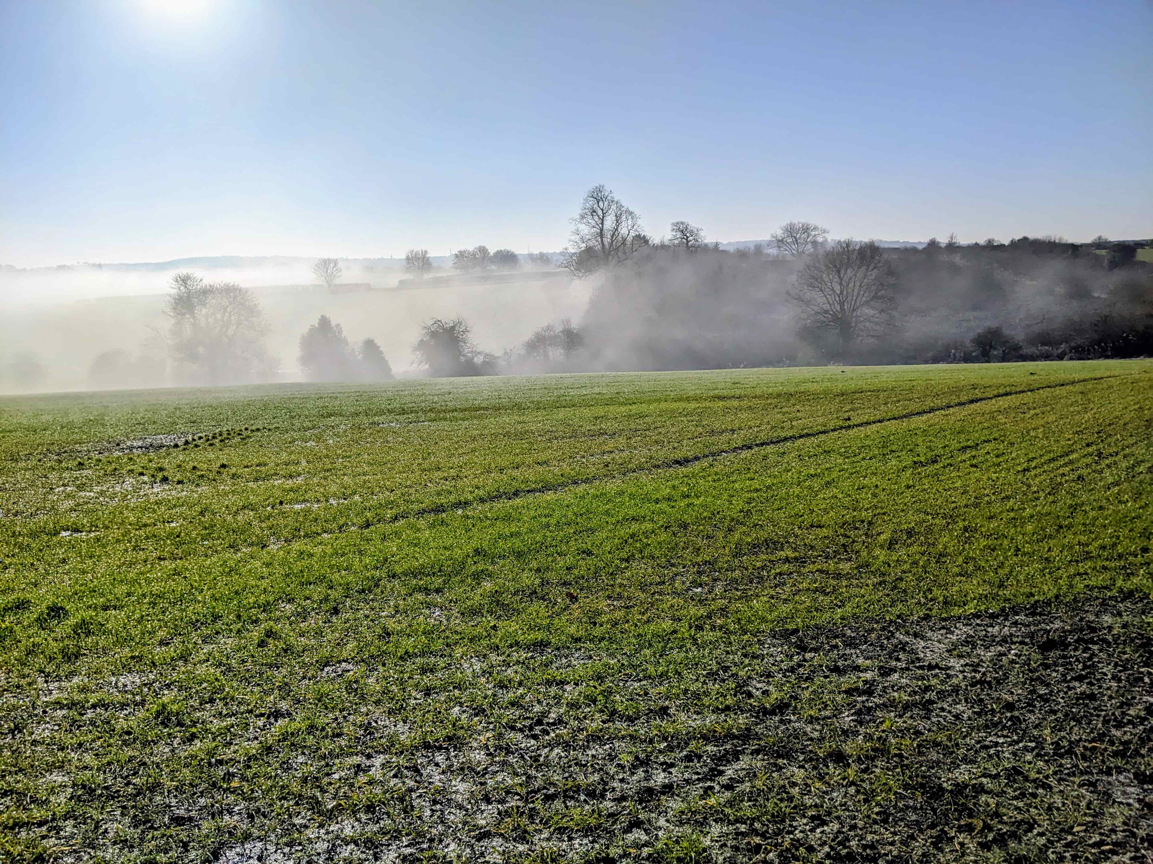
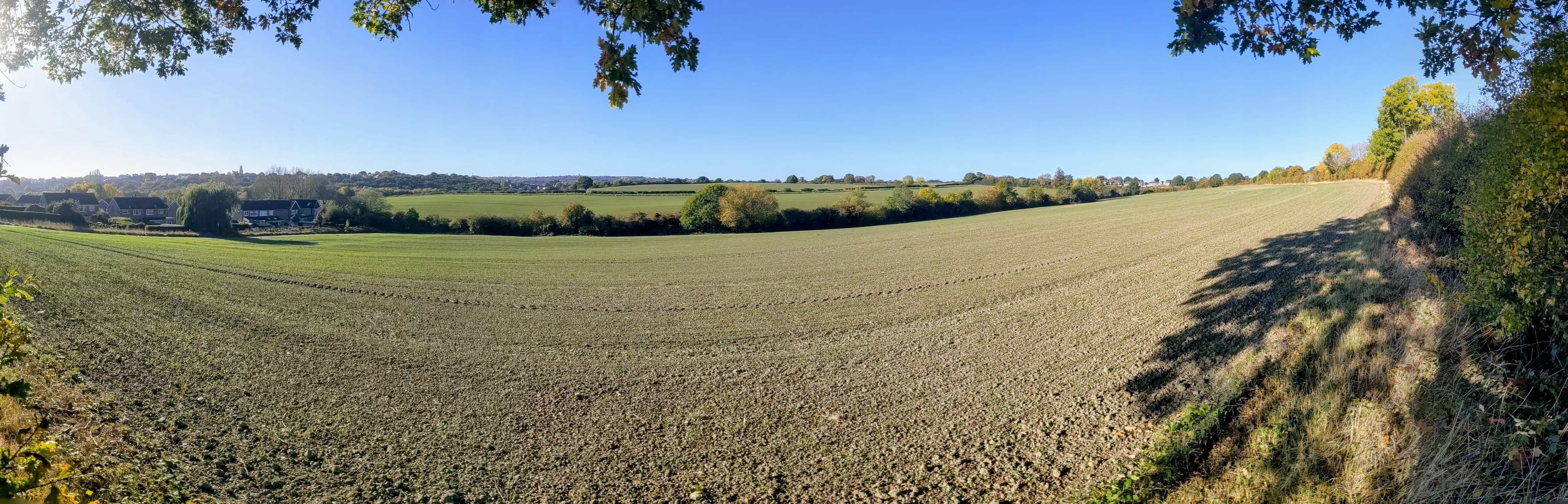
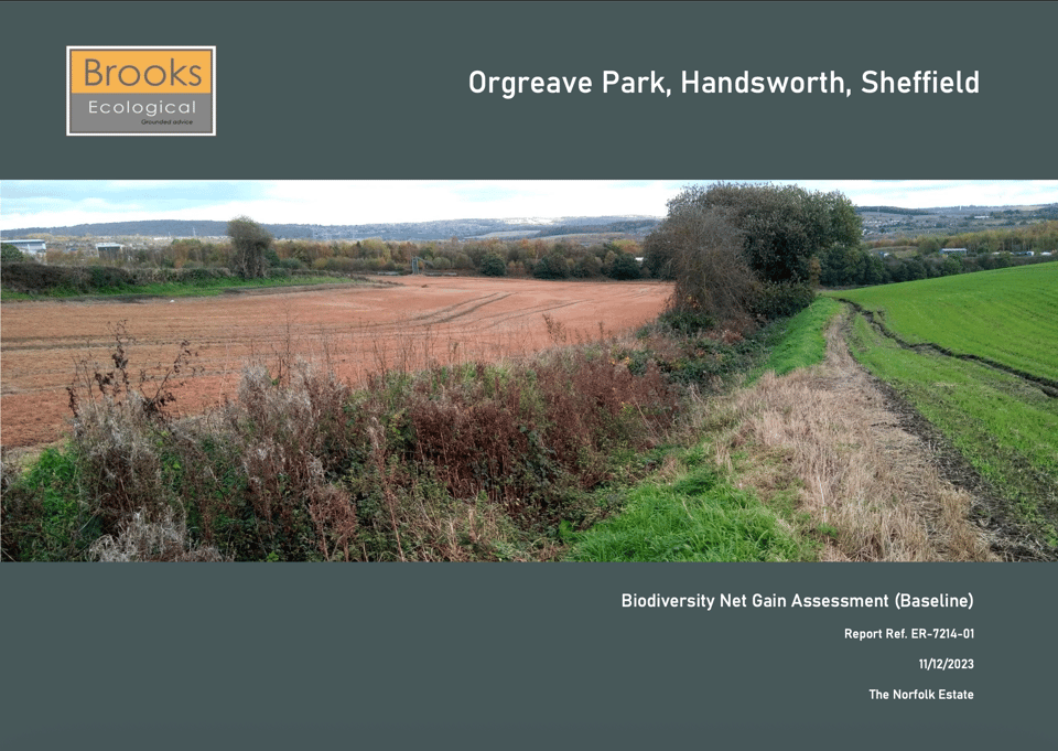
A view of the channel dug out along the beck - .The scale of the channel - .Before the works: the front cover of the December 2023 biodiversity assessment (PDF).Uprooted trees and shrubs being burned beside the JCB - .
Residents describe what was there before the works as native hedgerow along a spring-fed beck, in a known area for badgers. The December 2023 biodiversity assessment recorded high-distinctiveness habitats on the site: the kind that is hardest to replace and counts most when a site’s ecology is measured.
How concerns were raised
Residents reported the work to the police, the Sheffield and Rotherham Wildlife Trust and planning enforcement on 3 September. Local councillors then raised it with Council leaders, planning officers and other agencies.
Councillor Nathaniel Menday submitted a formal complaint and an urgent enforcement enquiry to the Council’s Planning and Planning Enforcement teams. He also alerted the Environment Agency and the Wildlife Trust.
Councillor Alison Norris phoned Council Leader Fran Belbin, who in turn spoke to the Council’s Chief Executive, Kate Josephs. Councillor Norris also visited the site with residents and sent photographs and video of the damage to the Leader.
Councillor Mick Rooney escalated the concerns to planning officers, including Planning Enforcement and the Head of Planning.
Clive Betts’s office also took the matter up and contacted the company preparing the developer’s environmental assessment. We thank all three councillors and the MP’s office for acting quickly.
A resident also raised the matter with the Forestry Commission. As at 13 September, we did not know what action, if any, it was taking.
What the Council says, and what we say
The Council’s response
The Council’s first answer, on Friday 4 September, came after a phone call with the developer’s planning agent. The agent described the work as maintenance of drainage dykes by a tenant farmer. On that basis, planning enforcement said no breach of planning control had occurred.
A fuller reply followed on 9 September, and the Service Manager for Development Management repeated it on 11 September. The Council said:
The land is part of an agricultural holding of more than 20 hectares. It considered the excavation and engineering works to be permitted development on a holding above 5 hectares, and said it could not take enforcement action against the groundworks.
None of the trees had a Tree Preservation Order.
A tree officer had visited, but the Council had not been able to show that the vegetation met the legal definition of a protected hedgerow. It took the view that the shrubs had self-seeded along the ditch rather than being planted or kept as a field boundary. On that basis, it said it could not serve a Hedgerow Replacement Notice.
Concerns about badgers were a matter for the police.
Why we challenge that account
We do not accept that account, and nor do the residents who know the beck. It is a natural, spring-fed watercourse, named as Handsworth Beck on historic maps, not a drainage dyke. Residents describe the hedgerow along it as continuous, more than 20 metres long and more than 30 years old, and dispute the Council’s assessment of its protection.
The scope of works the agent described - "removal of shrubs and selected tree(s)" - does not describe what was done. And people on site told residents the land was back under the control of the Handsworth Farm Partnership, not a tenant. The Wildlife Trust has been helping to characterise what was there and making its own representations to the Council.
As at 13 September, we still did not know who commissioned the work or which contractor carried it out. The Council had been given one account by the developer’s agent; residents on site had been given another. No contractor had been named.
Who is taking responsibility?
The police attended on 3 September and told residents this was a matter for planning enforcement. Planning enforcement says harm to wildlife is a matter for the police.
Counting habitat does not bring it back
Both the Council and the developer’s consultants say the loss will be dealt with through the biodiversity baseline - the record of habitat against which a development’s losses and gains are measured.
The Council says that if a planning application comes forward, the baseline will be taken from what was there before the works, "with a presumption of high value and high distinctiveness habitat", and the developer will have to make good that loss plus 10 per cent.
The company preparing the developer’s environmental assessment told Clive Betts’s office that the site was surveyed by ecologists in May 2026, so the works "would not degrade the ecological baseline".
Both are describing the same thing: habitat that will be counted as if it were still there. It is not.
What happens next
As at 13 September 2026, the land remained Green Belt and the Local Plan was still being examined. An allocation in a draft plan is not a planning permission.
The Council said it was still reviewing the information it held, would welcome further evidence about the hedgerows, and had offered to register a formal complaint once the specific grounds were set out. Members of the campaign were gathering evidence and preparing those grounds.
If you have photographs of Handsworth Beck and the hedgerow before 3 September 2026, from any year, or you saw the work being done, please email the campaign at info@saves13greenbelt.org.uk.
Photographs with dates are the most useful. Please include when and where they were taken, or the date, location and details of what you witnessed.
Keep watch on Green Belt sites
Please keep watch on this site and on every Green Belt site in the Plan. If you see machinery, clearance work or low-loaders delivering diggers:
Note the date, time and location.
Record any registration plates or company names you can read.
Photograph from a public place. Do not confront anyone.
Let the campaign know using the email address above.