Flooding
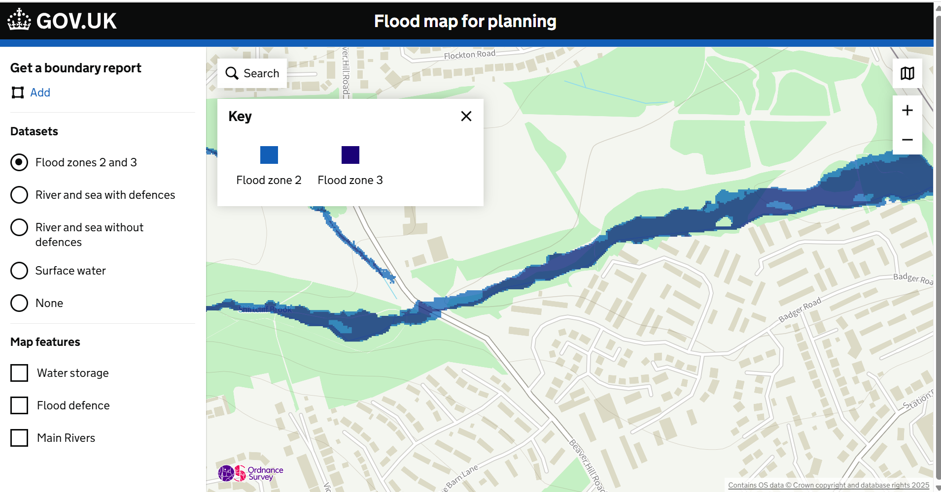
To see the flood risk for SES30, you can use the Environment Agency Flood map for planning
The south east corner of SES30 site is a category 3 flood risk
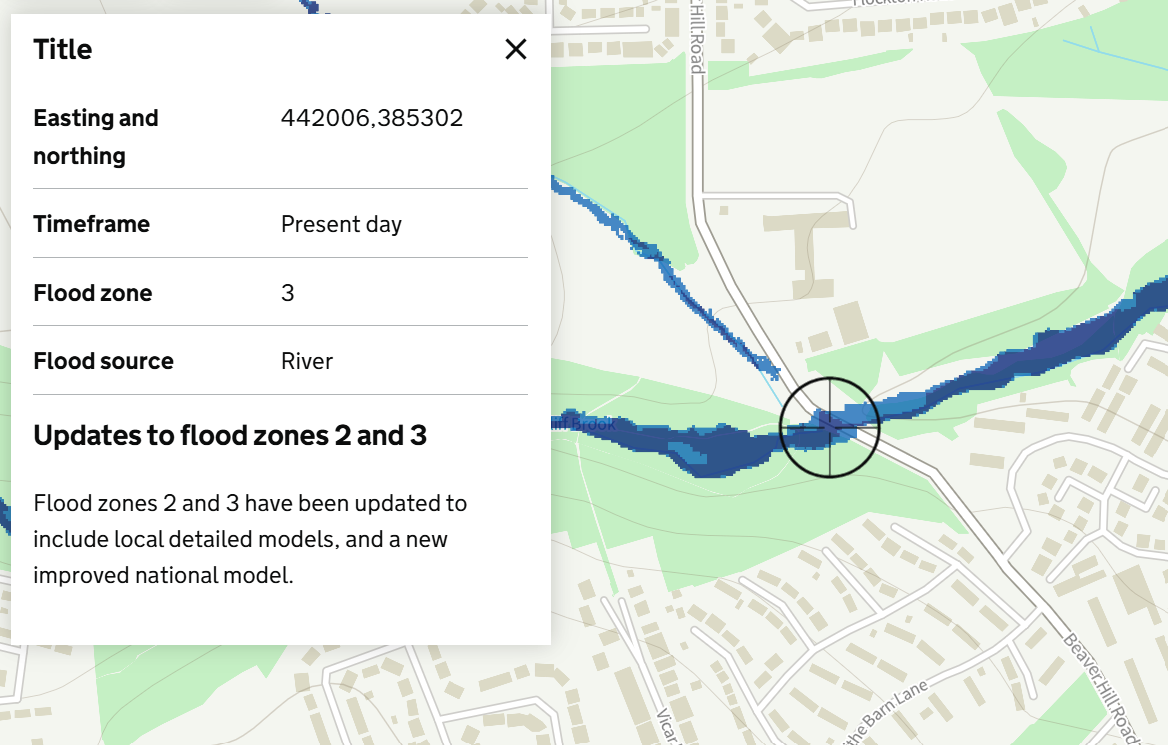
The run-off from SES30 feeds into flood plains downstream on the Badger Estate